 |
 |
 |
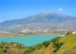
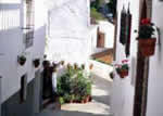
 The municipality of Sedella has the shape of a rectangular prism whose north side begins at the crest of the Tejeda mountain range. Here, near the peak of La Maroma in the province of Granada, it reaches a height of 2,000 metres. The mountains drop abruptly to the vicinity of the village, but not before forming deep ravines in which, terrain permitting, there are small pine groves that soften the geographic harshness of the surroundings.Beginning at the village the landscape becomes gentler and one begins to see houses scattered about on some of the hills and brushy areas, fields and pastures alternate with lush, green pinewoods. Two streams, one of which has its headwaters at El Pardillo and the other at Fuente Chaparro, join a few kilometres from those places and form the River Sedella
The place where these two streams run together, known as Cerillales de la Fuente, is of great scenic beauty. The Matanzas and Granados streams also flow through this municipality, and each has a separate legend attached to its waters that is based on ancient battles and supernatural acts.As far as the origin of Sedella is concerned there is the same uncertainty as with so many other municipalities in La Axarquía, but there are physical traces that, while lacking concrete data or precise documentation, shed light on a certain era and may apply in a general way to the history of an entire territory. In the case of this village, the discovery of a number of Roman coins and some Punic ceramic remains in the vicinity of the village shows at least that there was human traffic during the period to which these relics belong, but this does not imply the existence of a more or less permanent settlement.
There is also no great certainty about the origin of the village’s name, although it seems safe enough to say as some researchers do that the name of Sedella comes from the Latin “sedilla”, which might be translated as “rural location”. Before the Muslim domination the village appears under the name “Sedille”, as is shown on a seventh century map, and at an earlier date it even appears as Sedilla.The Arab Al-Razi, when referring in the year 927 to the territories conquered by Abderramán III, speaks of the fortress of Comares, of that of Santo Pítar and that of “S. D. Lía”, about which he specifies that it was always inhabited by Christians. It is quite clear that the initials with which the author named the place where a fortress was located correspond to present-day Sedella. It was during the Muslim period that Sedella began to grow and develop as a village, now under the name of Xedalia. It would surrender to the Catholic Monarchs on 29 April 1487, two days after the fall of Vélez-Málaga.
Juan de Hinestrosa was named commandant of the fortress of Xedalia, but the village was granted to Martín Fernández de Córdoba. It would later come under the jurisdiction of Málaga against the wishes of Vélez, which claimed it simply because of its proximity, among other reasons. In 1543, the Lordship of Sedella was acquired by Gabriel de Coalla, at that time castle commandant of the village, who took advantage of the Crown’s need to collect money for war to buy the municipality of which he was the commandant for 30,000 maravedíes.
The fact that Andrés Xorairán, one of the ringleaders of the Moorish rebellion, was born in Sedella was decisive in the locality becoming one of the first flash points of this uprising, which ended tragically with the fall of Peñón de Frigiliana to the troops of Luis de Requesens in 1569. Two years later Felipe II ordered the expulsion of the Moors and the municipality was practically depopulated until the arrival of Old Christians, mainly from La Mancha and CarmonaThe earthquake of 1884 caused incalculable damage in the village but no lives were lost. Sedella was allotted 19,000 pesetas in the distribution of disaster relief.
 |
 |
 |
| Surface Area: | 32 square kilometres |
| Population: | about 500 |
| What the natives are called: | Sedellanos. Nickname: Sellanos |
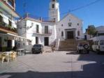
| Monuments: | the San Andrés church, Casa del Torreón (House of the Tower), and the Virgen de la Esperanza hermitage |
| Geographical Location: | in the north-eastern part of the La Axarquía region. Its area of greatest altitude borders the province of Granada. The village is 690 metres above sea level and is 54 kilometres from Málaga, 23 from Vélez Málaga and 8 from Canillas de Aceituno, the closest village. The average rainfall in the area is 670 litres per square metre and the annual average temperature is 17º C. |
| Tourist Information: | Town Hall, Calle Andalucía, 11 (29715) |
| Telephone: | 952 508 839; Fax: 952 508 838 |


