 |
 |
 |
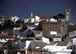
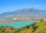
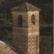 The tiny municipality of Salares, nestled against the formidable mass of the Almijara Mountains, spreads its territory along a narrow strip that borders the province of Granada to the north and in the south penetrates almost to the heart of La Axarquía. If you take into account that this small territory reaches a height of 1,658 metres on the Cerro del Puerto peak and that only seven kilometres south the elevation has dropped to 480 metres you will have some idea of how broken and rugged the terrain is within the boundaries of this municipality.The bare rocks that crown the highest peaks accentuate even more the greenery in the environs of the village, near which flow the Rivers Salares and Sedella. These two rivers collect waters from the mountains to irrigate a number of tremendously productive agricultural areas, and where water is scarce, grapes make their appearance as the main crop.
The geographic characteristics of the territory of Salares–abundant water, favourable temperatures and excellent shelters in case of unforeseen attacks-attracted the attention of the Phoenicians, Greeks, Carthaginians and, of course, the Romans who coined the village’s first name: Salaria Bastitanorum, in reference to a salt deposit that apparently existed in this area.Except for a bridge that is still preserved, however, the Romans’ passage through Salares is overshadowed by the imprint of the Arabs, who did leave important evidence, such as the configuration of the village itself and a fortress of which one tower still stands and under whose shelter the village took shape.Just as in the case of so many other villages in La Axarquía after the fall of Vélez Málaga in 1487, Muslim representatives from Salares went to the regional capital to surrender to the victors. This act took place just two days after the taking of Vélez, which is to say 29 April 1487.
The lands of Salares, along with those of the other adjacent villages (including Benescalera, of which today no trace remains), were granted as feudal holdings to Don Pedro Enríquez, the adelantado mayor (civil and military governor) of Andalusia, and at his death they were inherited by his widow. The persecutions that the Moors were subjected to for years by the Christians sowed the seeds of generalised discontent that broke out into open rebellion in 1569. The Moorish uprising in La Axarquía was fomented by the chieftain Martín Alguacil and began in the localities of Sedella, Canillas and Salares. It ended in the famous Battle of El Peñón in Frigiliana. When the Moors were expelled in 1571 there were 92 from Salares among them, according to the chronicles.In 1572, the population of Salares and the now-vanished Banescalera totalled about 550, and there was in operation a flour-mill, an olive oil mill, two fisheries, 20 threshing rooms, eight lime pits and ten apiaries. Apparently a large proportion of the villagers were engaged in silk production, which at that time was one of the products most in fashion.No lives were lost in the earthquake of 1884 that shook all of La Axarquía so violently but it did cause incalculable material damage. The royal commissioner in charge of evaluating the damage designated about 30,000 pesetas to help the villagers rebuild their homes and replace belongings.
 |
 |
 |
| Surface Area: | 10 square kilometres |
| Population: | about 200 |
| What the natives are called: | Salareños |
| Monuments: | the Santa Ana parish church (with Mudéjar minaret-tower), Roman bridge over the River Salares, Albarrá fountain, Cerro del Puerto peak |
| Geographical Location: | in the La Axarquía region, at the foot of the Almijara mountains and 580 metres above sea level. It is 58 kilometres from the city of Málaga and 28 from Vélez Málaga. The municipality records an average rainfall of 670 litres per square metre and the average temperature is 17º C. |
| Tourist Information: | Town Hall, Calle Iglesia, 2 (29714) |
| Telephone: | 952 508 903; Fax: 952 508 905 |


