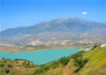
 The south slope of the Almijara mountain range takes up a large part of the municipality of Frigiliana and its topography is complex and rich in contrasts, with peaks that, without reaching the heights of that mountain mass, do easily exceed 1,000 metres, such as Sierra de Enmedio (1,164 metres), or that are close to that height as in the case of El Fuerte (976 metres).
The River Chillar marks the boundary of this municipality and that of Nerja, and its tributary the Higuerón provides, with its so-called Hoces del Río Higuerón (Gorges of the River Higuerón), one of the most striking natural sites in the entire area. It, and the cliffs and gorges of the River Chillar itself, form an incomparably scenic landscape. The terraced market gardens that, at the village, begin their descent toward the coast, between the dazzling white of the houses and the blue Mediterranean in the background, are another feature of an area whose image will remain engraved in the traveller’s memory for a very long time.
Travellers coming to Frigiliana for the first time will probably have a preconceived idea about the village, since many different clichés have been used to describe it. In fact, these same clichés could describe any of the typical Andalusian mountain villages that look out over the sea. In this case, however, all the clichés are true. and are even surpassed by an ineffable sensation that is as hard to describe as it is easy to perceive and that perhaps no one can accurately identify unless by resorting to another cliché: bewitchment.
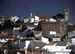
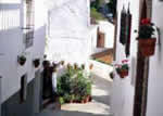
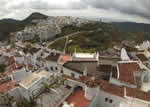
Clichés aside, the historic quarter of Frigiliana, of all those in the entire province, is considered to be one that has best preserved its original Moorish form. Its anarchic street plan-anarchic from the twenty-first century perspective-leads the visitor from one surprise to another: unexpectedly massive architecture, streets, alleys, covered passageways, stairways, plants and flowers in the most unlikely places, a mixture of fragrances from hidden sources, ancient history in new whitewash… And once you leave the intimacy and constriction of its streets, the breadth of a superb landscape above the Eastern Costa del Sol.
Remains found in 1987 in the Cueva de los Murciélagos (The Bat cave) attest to the presence of man in this territory from the late Neolithic period (3,000 B. C.) until the Calcolithic or Copper Age (2.000 B. C.). There is a menhir (standing stone) from the late Algar culture that provides evidence that man was present in this area in that era, and very near the village is the Cerrillo de las Sombras necropolis from the Phoenician epoch (700-600 B. C.).
The Romans occupied this territory in 206 B.C. through treaties with the native population and, Frigiliana was included in the Conventus de Gades. The name of the village comes from the Romans. It derives from Frexinius (a personage about whom nothing is known) and the suffix “ana”, which means source, that is to say the place or villa of Frexinius.
Little is known about the history of Frigiliana from the arrival of the Arabs to the Peninsula in 711 A. D. until the late ninth century, when the fortress was built, except that it was under the leadership of Omar Ben Hafsun. During the thirteenth and fourteenth centuries, it formed part of the Nazarite Kingdom. The village surrendered to the Christian troops in 1485 without bloodshed.
Bit by bit, however, the Moors were stripped of the few rights that they had (they farmed the worst soil and were forbidden to speak and write their language or wear their traditional dress) until the Moorish rebellion broke out in the Alpujarras mountains and was brutally put down by the Christians. The Moors from La Axarquía and the Málaga mountains, expecting the aid promised by Aben Humeya from the Alpujarras and also aid from North Africa, sought refuge in El Fuerte de Frigiliana (the Fort of Frigiliana), where some 7,000 of them gathered.
On 28 May 1569, the corregidor (magistrate) of Vélez began the first assault with the ominous outcome of 20 dead and 150 wounded among the Christian troops. At that time, 25 galleys of the Italian fleet were sailing in the Mediterranean and the corregidor of Vélez asked for assistance in squashing the Frigiliana insurgents. On this occasion, it was 6,000 men who confronted the Moors, who were defeated despite their resistance on 11 June 1569. There were 2,000 killed and 3,000 captives among the defeated forces (some 2,000 escaped) and 400 dead and 800 wounded among the victors.
The Battle of El Peñón de Frigiliana has been reproduced by Amparo Ruiz de Luna, somewhat in the manner if a “romance de ciego” ballad, on glazed ceramic panels that can be seen at the present time in various places in the village.
From that date until the nineteenth century, misfortune rained down upon Frigiliana. When it was not the plague that decimated the population, it was a storm that destroyed the crops, or an earthquake, or the phylloxera pest that attacked the grapevines or an outbreak of yellow fever that caused havoc. It would not be until the arrival of tourism that Frigiliana, like the rest of the Costa del Sol, entered into a period of prosperity and social and economic peace.
 |
 |
 |
| Surface Area: | 25.3 square kilometres |
| Population: | about 2,300 |
| What the natives are called: | Frigilianenses. Nickname: Aguanosos |
| Monuments: | the San Antonio church, former granary, Palacio de los Condes de Frigiliana (Palace of the Counts of Frigiliana), Ecce Homo hermitage, walls of the Castillo de Lizar (Lizar castle), Palacio del Apero (El Apero palace), Algar culture menhir (standing stone), and the Phoenician necropolis |
| Geographical Location: | in the eastern part La Axarquía, in the foothills of the Almijara mountain range. The village is more than 430 metres above sea level. It is 56 kilometres from the provincial capital and only 6 from Nerja. The area records an average annual rainfall of about 600 litres per square metre and the average temperature is 18º C. |
| Tourist Information: | Town Hall, Calle Real, 80 (29788) |
| Telephone: | 952 533 002; Fax: 952 533 434 |


