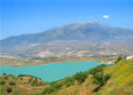
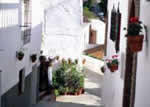
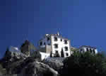
 To understand certain things you sometimes have to admit that truth can surpass fiction. A case in point is the location chosen for this village, which was eminently justified a few centuries ago due to defensive considerations but that nowadays can’t help but surprise even the visitor who has informed himself beforehand about the peculiarities of Comares.
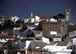
In the case of this municipality it is almost pointless to describe the characteristics of the landscape because once you get to the village you will command a view of an expanse of terrain from the mountains to the sea, where not only the geographic features are visible but also the crops and vegetation of an area that is considerably larger than that of the municipality, which is known with good cause as the “Balcony of La Axarquía”.
The urban district stretches across two hills at an altitude of nearly 700 metres. In such a mountainous territory as the province of Málaga, such heights are not especially noteworthy but in this case, considering the dizzying steepness of some of the slopes of the natural watchtower that is Comares, they are more than commonly picturesque.
The fact that there is no easy access to this village has spared it from the development excesses that, with such “joy”, have been perpetrated in other places, so a stroll through its maze of streets is something that the visitor will enjoy and will certainly recommend.
The Romans were aware of the advantages of this lookout point and apparently set up a military post on it, and the Arabs later erected a fortress-the Comares castle-that along with those of Zalía and Bentomiz made up the three defensive mainstays of the La Axarquía region. On the Masmullar hill, not far from the village, the ruins have been found of a city from the ninth and tenth centuries A. D. whose cistern has been preserved and was declared a Historic-Artistic Monument in 1931. Some researchers have seen these ruins as being those of Bobastro, so closely linked to Omar Ben Hafsun.
After a series of alliances and betrayals between Moors and Christians the village was surrendered to the Catholic Monarchs in 1487 by its last Muslim castle commandant, Mamad el Jabis, and years later it formed part of the lands of Diego Fernández de Córdoba. It is known that the Moorish population did not take part in the sixteenth century uprising but nevertheless the residents of Comares were expelled and the area was repopulated by people from other places.
 |
 |
 |
| Surface Area: | 25.3 square kilometres |
| Population: | approximately 1,400 |
| What the natives are called: | Comareños. Nickname: Moriscos |
| Monuments: | the Comares castle, La Encarnación church, and the Mazmúllar cistern |
| Geographical Location: | in the La Axarquía region, bordering the Málaga Mountains, 28 kilometres from the provincial capital and 24 from Vélez Málaga. The village is 700 metres above sea level. Average rainfall in the area is 580 litres per square metre and the average temperature does not exceed 17º C. |
| Tourist Information: | Town Hall, Plaza Balcón de la Axarquía (29195) |
| Telephone: | 952 509 233; Fax: 952 509300 |


