Algarrobo History
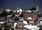
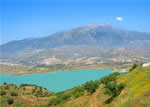
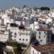 This small municipality, whose area is less than 10 square kilometres, extends over a territory where the mountains of La Axarquía begin to soften their edges before forming their coastal profile. It is crossed from north to south by the River Algarrobo-Sayalonga, which flows through a valley whose landscape was once covered by olive and almond trees and vineyards but is now undergoing substantial changes due to the cultivation of subtropical products and vegetables, so the gentle slopes are being taken over by the terraces needed by these new plantations.The urban nucleus of Algarrobo, of Moorish outline, is three kilometres from the coast. In order to distinguish the beach zone, which is undergoing large-scale development, from the village proper the convention has been adopted of calling it Algarrobo-Costa, something that is not unique to this locality since it is a relatively newly coined expression used in other municipalities in Málaga.Historical evidence exists that there were human settlements in the municipal territory of Algarrobo since the Bronze Age, in the form of discoveries in the area of El Morro de Mezquitilla. The most important archaeological legacy ever found in Algarrobo, though, is the Phoenician necropolis of Trayamar (seventh century B. C.). The Romans also left their stamp here but the later Visigoths apparently could derive no benefit from these lands, although the Arabs were able to, during their long stay.
After the surrender of Vélez to the Christian troops in 1487, Algarrobo followed the example of many other villages in the region and sent representatives to the Catholic King to deliver the village to him. The lordship (Señorío) of it was granted to Don Pedro Enríquez. Upon his death, it passed into the hands of his widow Doña Catalina de Rivera. In 1519, the heirs sold the lordship of Algarrobo to Pedro Fernández de Córdoba, the Marquise of Comares. That remained the status of these lands until the Cortes de Cádiz abolished the Señorío system in 1811
| Surface Area: |
9.7 kilometres |
| Population: |
approximately 5,000 |
| What the natives are called: |
Algarrobeños |
| Monuments: |
Santa Ana parish church, San Sebastián hermitage, watchtowers, and the Trayamar archaeological sites (Phoenician) |
| Geographical Location: |
in the coastal area of the La Axarquía region, 32 kilometres from the city of Málaga. The centre of the village is 3 kilometres inland from the coast and sits 86 metres above sea level. Average annual rainfall is 610 litres per square metre and the average temperature is 18.5 º C. |
| Tourist Information: |
Town Hall, Calle Antonio Ruiz Rivas, 2 (29750). |
| Telephone: |
952 552 430; Fax: 952 552 423 |
 This small municipality, whose area is less than 10 square kilometres, extends over a territory where the mountains of La Axarquía begin to soften their edges before forming their coastal profile. It is crossed from north to south by the River Algarrobo-Sayalonga, which flows through a valley whose landscape was once covered by olive and almond trees and vineyards but is now undergoing substantial changes due to the cultivation of subtropical products and vegetables, so the gentle slopes are being taken over by the terraces needed by these new plantations.The urban nucleus of Algarrobo, of Moorish outline, is three kilometres from the coast. In order to distinguish the beach zone, which is undergoing large-scale development, from the village proper the convention has been adopted of calling it Algarrobo-Costa, something that is not unique to this locality since it is a relatively newly coined expression used in other municipalities in Málaga.Historical evidence exists that there were human settlements in the municipal territory of Algarrobo since the Bronze Age, in the form of discoveries in the area of El Morro de Mezquitilla. The most important archaeological legacy ever found in Algarrobo, though, is the Phoenician necropolis of Trayamar (seventh century B. C.). The Romans also left their stamp here but the later Visigoths apparently could derive no benefit from these lands, although the Arabs were able to, during their long stay.


