 |
 |
| Essential Alcaucin Information | Alcaucin Bars & Restaurants | Alcaucin Photos |
Alcaucin History
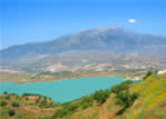
 The territory of Alcaucín, in the northern part of La Axarquía on the border of the province of Granada, stretches between the imposing Sierra de Tejeda, the rugged Boquete de Zafarraya –a natural gap between the coast and the interior- and the Periana corridor, where the topography tends to be gentler. Its municipal boundaries, therefore, contain exceptionally varied and surprising geographic features, giving it a spectacular wealth of scenery.
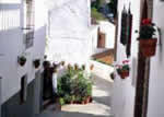
While archaeological relics of tremendous importance have been found within its limits (ceramics from different eras and a Neanderthal jawbone), the urban nucleus of Alcaucín was established in the Arabic era, from which it preserves its name, Alcavzin or Alcautin, whose approximate translation is “the arches”. Narrow and winding streets, whitewashed houses, interior courtyards brimming with plants and flowers, stairways over uneven terrain and steep slopes attest to the Moorish design of this village, whose residents must undoubtedly have participated in the Moorish uprisings that occurred in sixteenth century La Axarquía, although this is not documented.
It is known, though, that in 1569, the Moor (Christianised Moor) Andrés de Xorairán attacked Alcaucín, but this uprising like so many others was quickly put down by Christian troops.The earthquake of 25 December 1884 particularly affected this village, where in addition to extensive material damage (alteration of subterranean streams, destruction of dwellings and buckling of roads and trails), there was much loss of life. To make the situation worse, there was a heavy snowfall that year that made getting assistance to the village still more difficult.
 |
 |
 |
| Surface Area: | 46 square kilometres |
| Population: | approximately 1,600 |
| What the natives are called: | Alcaucineños |
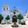
| Monuments: | Nuestra Señora del Rosario church, Nuestro Señor del Calvario hermitage, Cinco Caños fountain, Zalía castle |
| Geographical Location: | in the northern part of the La Axarquía region, 20 kilometres from Vélez-Málaga and 54 from Málaga capital. It lies 508 metres above sea level. The average annual rainfall exceeds 900 litres per square metre and the average temperature is 16º C. |
| Tourist Information: | Town Hall, Plaza de la Constitución, 1 (29711). |
| Telephone: | 952 510 002; Fax: 952 510 076 |


