 |
 |
 |
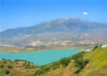
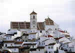 This municipality stretches on one side between the regions of La Axarquía and the Málaga Mountains and on the other it also adjoins the Antequera mountain range, so the resultant landscape is something of a compendium of three zones that meet in the municipal territory. It has limestone areas similar to those of Antequera in which there is more rock than vegetation, and other less steep areas that allow the growth of olive trees, cereal grains and low brush.
Archaeological sites that have been discovered in some parts of the municipality show beyond a doubt that there were already human settlements in this area in prehistoric times, which is only to be expected given the location of Colmenar, which must have been one of the routes that linked La Axarquía and the Málaga mountains with the Guadalhorce valley. This can be inferred from the remains found in the Cueva de las Pulseras (Las Pulseras Cave, from the Neolithic period) and at El Cortijo de Gonzalo along the Las Zorreras stream, which are from the Metals Age.
Except for a few coins and ceramics from the Roman era, however, there are no remains showing the existence of a city or fortress from that age. It would not be strange, however, if sooner or later some such traces-a villa, at least-did show up, since they have been found in places not very distant from Colmenar. There is also no remaining construction of any kind from the Arabic domination, but there is a very interesting relic: a slate mold for casting coins that was found at the Las Guájaras farmstead.
One really cannot properly speak of the history of Colmenar before the taking of Vélez Málaga by the Christian troops in 1487. It is the opinion of the historian Vázquez de Otero that, “when the Catholic Monarchs took over Málaga and its territory, Colmenar did not exist as a village, but rather as an estate like so many others…”
We do know that in 1488 the castle commandant of Comares acquired the farmstead of Colmenar, and that in the mid-sixteenth century (1558) it is already being referred to in documents as the Señorío de Colmenar (feudal holdings of Colmenar), whose ownership would be grounds for lawsuits for many years until the royal burgh managed to achieve its independence in 1777. It would later be the judicial district seat for several neighbouring villages.
 |
 |
 |
| Surface Area: | 65.5 square kilometres |
| Population: | about 3,200 |
| What the natives are called: | Colmenareños. Nickname: Tinajeros |
| Monuments: | Santísima Virgen de la Candelaria hermitage, Nuestra Señora de la Asunción church, Puerta de la Cruz (La Cruz gate) |
| Geographical Location: | in the northern part of the Málaga mountains region, bordering on La Axarquía and the Antequera region. The village centre is almost 700 metres above sea level and is 35 kilometres from the provincial capital and 44 from Vélez Málaga. Average rainfall is 765 litres per square metre and the average annual temperature is 16.5º C. |
| Tourist Information: | Town Hall, Plaza de España, 9 (29170) |
| Telephone: | 952 730 000; Fax: 952 731 068 |


