 |
 |
 |
 The mountainous territory of the municipality of Casabermeja is in the southern part of the Torcal and Las Cabras mountain ranges and is crossed by the River Guadalmedina. Since the most remote antiquity, it has been one of the entry points from different localities on the coast, including the city of Málaga, to the interior of Andalusia. This access has been none other than the narrow and winding valley of the River Guadalmedina itself, along which runs a large part of the route of the A-4 (N-331) expressway, which has placed the village equally distant from Antequera and Málaga and has considerably shortened the distance between these three population centres.
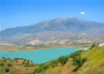
The scenery in these lands is anything but topographically monotonous, owing to the combination of gentle hills and the varied tree cover and crops to be seen on them: olive trees, almond trees, low brush, broad fields of grain and ploughed fields around the numerous farmsteads scattered across the countryside.
Remains of prehistoric settlements (paintings in Peñas Cabrera and an Neolithic burial site at Monte Calvario, among other relics) have turned up in the environs of the village, but it was the Romans who left the best evidence of their passage through the municipality. The pottery at Cerro Alcalde, the La Cotonilla ruins (a place very close to the La Molinera stream), and the ruins of the Las Parras fountain inside the village on Calle San Sebastián all belong to this era.
The origin of the village’s name is very probably Arabic, from Qsar Bemeja (Vermillion Castle). On the other hand, there is a popular tradition but one of unknown reliability that attributes to Isabela the Catholic the expression “Qué casa bermeja!” (“What a vermillion house!”) on her first sight of the village. The Queen must have named numerous localities in this way, since many villages preserve the same legend about their names.
There is no doubt that the Arabs were present in this territory, and ruins of an ancient wall and the Torre Zambra (Zambra Tower), on a hill commanding a view of a broad landscape, remain from that era. The present village was founded by the Catholic Monarchs, according to a document signed later by Juana la Loca and Carlos I in 1529 and 1550, respectively. A few years later, in 1630, the villagers received permission to purchase the villa (royal burgh) from the Crown.
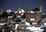
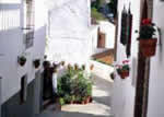
The construction of the modern expressway next to the town has favoured its expansion and at the same the construction of many dwellings, but the locality has not lost its original character, at least as far as the original urban quarter is concerned. It still preserves narrow streets and whitewashed houses of two stories at most, and some façades even still have niches where images of saints and the Virgin are placed for public veneration.
 |
 |
 |
| Surface Area: | 66.4 square kilometres |
| Population: | about 3,200 |
| What the natives are called: | Bermejos |
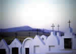
| Monuments: | the Nuestra Señora del Socorro church, cemetery, Torre Zambra (Zambra Tower) and Peñas Cabrera prehistoric complex |
| Geographical Location: | in the northern part of the Málaga mountains region. The village sits at 550 metres above sea level and is 20 kilometres from the provincial capital. The area records an average rainfall of nearly 600 litres per square metre and the annual average temperature is 16º C. |
| Tourist Information: | Town Hall, Calle Llanote de Abajo, 2 (29160).Telephone: 952 758 377; Fax: 952 758 009.
Tourist Office (from 12:00 noon to 3:00 pm on Saturdays and Sundays). Telephone: 952 758 458 |


