 |
 |
 |
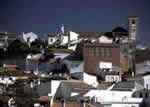
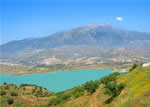
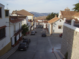 The municipality of Periana is framed in the north by the depressions of the Alhama and Enmedio mountain ranges, with the dominant peaks in that area being La Torca (1,499 metres), La Umbría (1,352 metres) and El Puerto del Sol (1,100 metres). The terrain slopes southward to the La Viñuela reservoir but first sprawls out into hills, lower than the aforementioned heights, and the village lies on these. Immediately afterwards the territory forms a ravine along the course of the River Guaro before it empties its waters into the La Viñuela reservoir, which is the only one in this region and the largest in capacity in the entire province of Málaga.
In such terrain as this, which includes notably high peaks, gentler hills of medium altitude and much lower elevations adjoining the reservoir, and which is also creased by several rivers (the Guaro, Seco, Vilo and Sabar), it is not strange that there are such widely different arboreal species and such highly diversified crops; the area’s spectacular topography exhibits simultaneously, depending on the spot, zones of evergreen oaks, olive groves, grain fields, pastureland, orchards-especially of peaches-citrus fruit and carefully tended market gardens farther down where water is close at hand.There were human settlements in the municipality of Periana at least since the Mousterian (Lower Paleolithic) period, as is shown by relics found at Cerro de Alcolea, near Mondrón; at the El Fuerte hill and in the Marchamonas shelter in the northern zone, where there have even been some pictorial remains found. Remains of Lithic workshops have also been found in the Capellanía area adjacent to La Viñuela, a site that was inhabited until the beginning of the Bronze Age.
These findings come as no surprise because the entire northern part of La Axarquía was occupied by man from the Prehistoric period, and Periana would hardly be the exception. There is nothing to indicate there were Roman settlements, however, despite the discovery of a coin from the late second century B. C. on the Capellanía hill.Nor are there records of Periana from the Arabic era, during which it presumably was no more than a farm community that was referred to in the chronicles of the time as simply a place passed through by the Christian troops who arrived from Archidona in 1487 to conquer Vélez. It would not become an actual village until the small San Isidro Labrador hermitage was converted into a parish church in 1761, at which time it ceased to come under the jurisdiction of Riogordo.
The effects of the sadly famous Andalusia Earthquake of 25 December 1884, which affected a strip of land 299 kilometres long by 70 kilometres wide, were felt with enormous force in Periana despite the fact that it was not at the epicentre of the quake. Many houses collapsed and 58 villagers perished. Faced with such a disaster, King Alfonso XII visited the village in January 1885 and designated the sum of 300,000 pesetas to help repair the damage. This amount was used to build the new church and a neighbourhood.
 |
 |
| Surface Area: | 58.5 square kilometres |
| Population: | about 3,500 |
| What the natives are called: | Perianenses. Nickname: “Los Manga Anchas” (“The Wide-sleeved Ones”) |
| Monuments: | the San Isidro Labrador church, Baños de Vilo bathhouses, headwaters of the River Guaro, and the panoramic views of La Axarquía. |
| Geographical Location: | in the northern part of the La Axarquía region, on the border of the province of Granada. The village is 550 metres above sea level. It is 23 kilometres from Vélez and 48 from the city of Málaga. The area records an average annual rainfall of 620 litres per square metre and the average temperature is 16º C. |
| Tourist Information: | Town Hall, Plaza de Andalucía, 1 (29710) |
| Telephone: | 952 536 167; Fax: 952 536 276 |


