 |
 |
 |
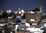
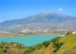
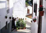
The unmistakable La Azarquía landscape, permanently watched over by the Tejeda and Almijara mountain mass, frames the municipality of Arenas. Its village centre, of clear Moorish origin, lies between the Cerro Alto peak and that of Bentomiz, both of which are about 700 metres above sea level. With the exception of these two high grounds, the terrain is composed of a succession of gentle hills abounding with almond and olive trees and grapevines, crops that occasionally yield to leafy pine groves that sprinkle the landscape with an intense green.
The unmistakable La Azarquía landscape, permanently watched over by the Tejeda and Almijara mountain mass, frames the municipality of Arenas. Its village centre, of clear Moorish origin, lies between the Cerro Alto peak and that of Bentomiz, both of which are about 700 metres above sea level. With the exception of these two high grounds, the terrain is composed of a succession of gentle hills abounding with almond and olive trees and grapevines, crops that occasionally yield to leafy pine groves that sprinkle the landscape with an intense green.
The crooks and turns that must be negotiated on the road before getting to Arenas afford beautiful wide angle views left and right of La Axarquía, and the backdrop of the sea that is visible not far in the distance is intermittently succeeded by views of the country farther inland, which are especially striking in the almond blossom season.
The Bentomiz fortress, built on a hill of the same name and close to the town, has played such a decisive role in the history of Arenas that no reference is possible to this locality without first alluding to the Bentomiz castle, whose origin has been dated to the Iberian era. It is believed that the Phoenicians, Greeks and Romans all successively occupied and modified it. Although there is a certain amount of confusion about which parts of its ruins belong to which era, the Roman sign is clear after discovery of some baths that with complete certainty belong to that period. In any event it was the Arabs, once again taking advantage of existing construction, who made an excellent defensive position of it, so much so that together with the castles of Comares and Zalía, Bentomiz castle was considered one of the three most important Muslim bastions in the central part of La Axarquía. Once the castle had been taken by Christian troops, its inhabitants, under a pact with Fernando the Catholic, were allowed to retain their religion and customs, privileges that they lost after the Moorish rebellion even though they did not participate in it. What they did do before losing those prerogatives was to swear allegiance to Aben Humeya, king of Granada, with the result that the Christians, not without serious confrontations, wound up occupying the castle to reinforce the guarding and defence of that area.
| Surface Area: | 26.2 square kilometres |
| Population: | about 1,200 |
| What the natives are called: | Areneros |
| Monuments: | the ruins of Bentomiz Castle, Santa Catalina church, the Arabic minaret and fountain in the outlying district of Daimalos |
| Geographical Location: | n the central part of the region of La Axarquía, 10 kilometres from Vélez Málaga and 44 from the provincial capital. The nucleus of population is 416 metres above sea level. The average annual rainfall is 630 litres per square metre and the average temperature is 17.5º C. |
| Tourist Information: | Town Hall, Plaza de la Ermita, 17 (29753) |
| Telephone: |
952 509 005; Fax: 952 509 005 |


